
Military Cartography: How Maps Won the World’s Wars
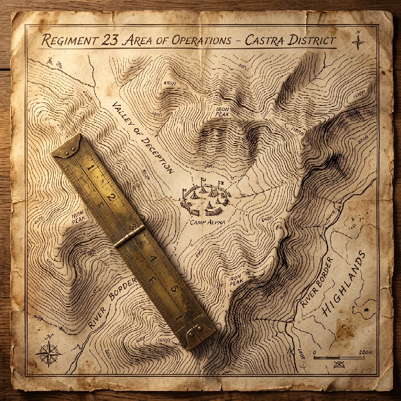
Long before the first musket flashed or cavalry charged, commanders fought their most decisive engagements over paper. The discipline of military cartography transformed combat from an erratic clash of arms into an exacting spatial science. By converting jagged ridgelines, marshy bottoms, and sunken tracks into reliable data, topographers gave generals the power to command terrain they had never seen.
Without precise spatial records, armies stumbled blind across hostile geography. The practice of military cartography eliminated that vulnerability by transforming landscape features into actionable weapons. A river ceased to be mere water; it became an operational barrier, an anchor for an exposed flank, or an inescapable kill zone.
The Antiquity of Spatial Command: From Rome to the Renaissance
Early commanders understood that victory required superior local knowledge, yet systematic recording remained crude for centuries. Roman campaign planners created itineraries (itineraria) listing marching distances, water sources, and staging stations along major military roads. These parchment scrolls served administrative logistics rather than fine tactical planning.
The emergence of measured military cartography accelerated during the Renaissance with the rebirth of Euclidean geometry and the spread of land surveying. Fortress designers in northern Italy began producing accurate scale plans of bastions to calculate arcs of defensive cannon fire. As siege warfare turned mathematical, field operations began demanding the same geometric rigor.
Sixteenth-century field commanders commissioned hand-drawn bird’s-eye views of campaign zones. These early drafts combined landscape illustration with rough compass bearings. While visually impressive, they lacked standardized elevation metrics and precise linear scaling.
The true breakthrough in early military cartography arrived with the widespread adoption of the surveyor’s plane table, the magnetic compass, and triangulation in the late seventeenth century. For the first time, royal engineers plotted the relative distance of church towers, river bends, and village crossroads without walking every yard between them.
Logistical Realities and Surveying Instrumentation
Field surveying during a dynamic offensive was grueling, dangerous work. Topographical officers rode ahead of advancing vanguards, sketching under fire while dodging enemy skirmishers and cavalry patrols. Their instruments were delicate, expensive, and difficult to calibrate amid blowing rain and dust.
The core toolkit of eighteenth- and nineteenth-century field topographers relied on specialized hardware:
-
The Plane Table: A portable wooden drawing board mounted on a tripod, fitted with a brass alidade for sighting distant terrain features directly onto paper.
-
The Gunter’s Chain: A measuring chain of sixty-six links used to establish accurate baseline distances across open ground.
-
The Sextant and Octant: Navigational tools adapted for land surveys to record precise solar angles and terrestrial elevations.
-
Pencil and Indian Ink: Waterproof iron gall inks and graphite sticks applied to linen-backed paper that could withstand mud and horse sweat.
Surveying in hostile territory required lightning calculations and mental resilience. Topographers recorded slope angles in degrees, noting whether a defile could support a four-horse artillery team or just single-file infantry. A road marked as viable on a faulty sketch could swallow a baggage train in two feet of black clay.
The production bottleneck in early military cartography was reproduction. Hand-drawn field sketches existed as unique, irreplaceable originals. If an engineer was captured or killed on his return to headquarters, weeks of hazardous reconnaissance vanished instantly.
Operational methods [Internal Link: Historical Topographical Survey Methods] matured as copperplate engraving and early lithography allowed central staffs to duplicate hundreds of identical map sheets overnight for corps commanders.
Reading the Earth: Elevation, Defiles, and Blind Zones
The tactical power of a map lies in its ability to expose what the naked eye cannot see from ground level. A commander standing on a flat valley floor faces severe optical compression; distant ridges blend together, and sunken ravines disappear entirely.
Sophisticated military cartography solved this problem through contour lines and hachuring. Hachures—short, parallel lines drawn in the direction of slope steepness—showed officers where terrain was impassable to cavalry. Contour lines, developed in the eighteenth century, connected points of equal elevation, allowing staff officers to calculate dead ground instantly.
Identifying dead ground was a matter of life and death on the battlefield:
-
Convex slopes created blind zones where advancing infantry could shelter from direct cannon shot.
-
Defiles and sunken farm roads offered concealed avenues of approach toward enemy flanks.
-
Reverse slopes shielded reserve infantry from shrapnel and fragmentation before an assault.
-
High military crests allowed batteries to dominate approach corridors without exposing their own gun crews.
A map that failed to indicate a five-foot drainage ditch could derail a synchronized infantry assault. Formations tripped, lost dressing, and clustered into disordered targets under defensive canister fire.
Through systematic military cartography, an army weaponized the environment. By funneling hostile formations into pre-sighted killing corridors, small detachments held off vastly superior numbers.
The Napoleonic Standard: The Bureau Topographique
No military institution advanced the practical use of maps faster than the French Dépôt de la Guerre and the Bureau Topographique. Under imperial patronage, French staff officers standardized cartographic symbols, color keys, and metric scale standards across the continent.
Before marching his corps into central Europe in 1805, the French emperor spent nights sprawled across immense floor maps, measuring distances with pairs of brass dividers tipped with red wax. He used pins of various colors to mark the projected positions of his divisions five to seven days in advance.
This reliance on rigorous military cartography enabled the famous bataillon carré formation. Marching along parallel roads spread over forty miles, autonomous corps advanced like the points of a diamond, aware of their exact spatial coordinates relative to one another.
When the enemy appeared, the nearest corps held the hostile host in place while adjacent corps wheeled inward across mapped connecting lanes to strike the flanks. The maneuver was impossible without maps that accurately recorded bridge capacities, road widths, and seasonal ford depths.
The French campaign of 1805 culminated in the destruction of an entire Austrian army at Ulm. That victory was achieved almost entirely through maneuver; French soldiers marched their opponents into surrender before a general engagement was ever fought.
Field logistics and operational intelligence [Internal Link: Napoleonic Staff Logistics and Doctrine] proved that superior mapmaking saved tens of thousands of infantry lives by substituting road speed for frontal attrition.
Jedediah Hotchkiss and the Valley Campaign
Across the Atlantic, the American Civil War demonstrated the catastrophic cost of poor mapping, and the decisive value of an exceptional cartographer. In 1861, both Union and Confederate field commanders lacked reliable, detailed maps of the Virginia theater. Regiments repeatedly marched down dead-end lanes or blundered into impassable swamps.
In March 1862, Confederate general Thomas J. “Stonewall” Jackson issued an urgent command to a former schoolteacher and self-taught surveyor named Jedediah Hotchkiss: “Make me a map of the Valley, from Lexington to the Potomac.”
Hotchkiss climbed into a custom wagon equipped with a drawing desk and set to work. Riding through blinding rainstorms and mountain gaps, he interviewed local farmers, measured road turnpikes, and surveyed the complex geography of the Shenandoah Valley.
The resulting masterwork of military cartography was a continuous, eight-and-a-half-foot linen-backed sketch map detailing every creek, blacksmith shop, mill, and ridge across hundreds of square miles. Hotchkiss’s work revealed a critical geographic feature that Union mapmakers had overlooked: the Massanutten Mountain.
The Massanutten was a fifty-mile ridgeline that split the Shenandoah Valley into two parallel corridors, accessible only through a single central gap. Jackson exploited this feature relentlessly. Using Hotchkiss’s spatial model, Jackson moved his army back and forth behind the mountain screen, striking isolated Union columns in succession.
In forty-eight days, Jackson’s army marched over 650 miles and won five major battles against three separate Union armies totaling three times his strength. The campaign remains a premier example of how military cartography can multiply combat effectiveness.
Tactical Execution: Hotchkiss at Chancellorsville
Hotchkiss cemented his reputation as an indispensable operational planner during the Battle of Chancellorsville in May 1863. The Confederate army faced an overwhelming Union force entrenched inside the dense wilderness around Chancellor’s crossroads. A frontal assault against those breastworks was impossible.
Late on the night of May 1, Hotchkiss was sent to locate a concealed route around the exposed Union right flank. Consulting local iron furnace managers and sketching through the night, Hotchkiss discovered the Brock Road, an obscure, overgrown wagon trail cutting through thick pine scrub.
His field sketch showed that Jackson’s entire corps could march twelve miles across the front of the Union army without being detected. The following morning, twenty-eight thousand infantrymen marched along the route plotted on Hotchkiss’s map.
At five-thirty in the afternoon, Jackson burst out of the woods directly into the flank and rear of the Union Eleventh Corps. The surprise was total; soldiers were eating supper and playing cards when the Confederate battle line rolled over their positions.
The flank march at Chancellorsville succeeded because of spatial precision. A single wrong turn down an unmapped logging road would have exposed the marching column to counter-destruction. Hotchkiss’s pencil guided the strike.
Modern Innovations and Modern Limitations in Military Cartography
As industrialized warfare expanded into the twentieth century, the scope and speed of tactical mapping underwent a violent revolution. The introduction of aircraft, aerial photography, and trench warfare in 1914 transformed the discipline from a craft into a massive industrial enterprise.
During the static meatgrinder of the Western Front, armies created vast trench maps at 1:10,000 scale. Thousands of photographic plates taken by reconnaissance aircraft were stitched together daily to plot enemy machine-gun nests, barbed-wire belts, and forward listening posts.
Modern military cartography had to evolve beyond static paper sheets:
-
Flash-Spotting and Sound-Ranging Maps: Topographers plotted the acoustic signatures of enemy artillery batteries to direct counter-battery fire.
-
Overprinted Barrage Maps: Trench maps were overlaid with color-coded creeping artillery lines, dictating the precise minute infantry were to advance behind falling shells.
-
Photogrammetry: The science of extracting reliable 3D measurements and elevation data from overlapping aerial images.
Yet technological complexity brought its own vulnerabilities. If artillery officers miscalculated grid declination or compass variations on their sheets, entire barrages fell upon their own frontline trenches.
Even in modern operations dominated by satellite positioning and digital elevation models, physical terrain remains unyielding. A digital display can fail, but the underlying topographical reality documented by military cartography still determines where tanks bog down, where helicopters find radar cover, and where infantry take shelter.
Archaeological Traces and the Cartographic Record
Today, the primary artifacts of this spatial warfare survive in national archives, field notebooks, and battleground earthworks. Researchers examining early campaign sketches find annotations written in graphite that match the actual shell craters and breastworks surviving in contemporary landscapes.
Archaeological excavations at European and American battle sites routinely rely on historical maps to locate forgotten defensive earthworks, artillery revetments, and burial pits. Hotchkiss’s field maps, now preserved in the Library of Congress, align with modern laser-scanned LiDAR data with astonishing accuracy, often within margins of mere yards.
This physical alignment illustrates the rigorous integrity demanded of field surveyors. An error in civilian land boundaries resulted in a court dispute; an error in military cartography led directly to slaughter.
The physical sheets themselves show the brutal conditions under which they were created. Many surviving field maps carry mud splatters, folded creases from saddlebags, and bloodstains from the officers who carried them into the fight.
These documents are not mere administrative records. They are the tactical blueprints of historical conflict, capturing the moment where human intention collided with raw geography.
The Strategic Legacy of Mapped Terrain
The long-term geopolitical outcomes of modern history were shaped fundamentally by which nations mastered spatial command. The unification of Germany under Prussian leadership was driven as much by the General Staff’s mapping department as by Krupp cannon.
Helmut von Moltke the Elder made topographical surveying a mandatory requirement for every general staff officer. When the Franco-Prussian War broke out in 1870, German officers carried detailed, uniform maps of French territory down to the village level, while French officers lacked adequate maps of their own country.
The resulting German victories at Sedan and Metz redrew the map of Europe. The balance of continental power shifted toward Berlin, proving that the nation with the superior grasp of landscape held the keys to victory.
From the muddy defiles of the Shenandoah to the shattered ridgelines of the Ardennes, commanders who respected the land and recorded its secrets triumphed over those who relied solely on courage and numbers. The quiet work of military cartography transformed the bloody chaos of the battlefield into an arena where spatial intelligence reigned supreme.
Frequently Asked Questions
What is the primary difference between civilian and military cartography?
While civilian cartography focuses on property boundaries, political borders, and basic navigation, military cartography emphasizes operational terrain analysis. It prioritizes relief data, slope gradients, dead ground, obstacle passability, weapon sightlines, and logistical transport capacity necessary to conduct combat operations.
How did topographers measure elevation before satellite technology?
Early military cartographers measured elevation using barometric altimeters, surveyor’s levels, and trigonometric leveling. By measuring vertical angles to prominent landmarks with sextants or theodolites and calculating distances through baseline triangulation, they derived precise topographical contours and hill heights.
Why was Jedediah Hotchkiss so vital to the Confederate war effort?
Jedediah Hotchkiss was vital because he provided Confederate commanders with accurate, detailed maps of regions that Union forces had failed to survey adequately. His exceptional spatial precision enabled lightning marches through mountain corridors, kept supply lines open, and revealed vulnerable enemy flanks that decided major campaigns