
Croatoan Carving Mystery: What Happened at Roanoke?
The Atlantic wind bit sharply at John White as his ship crossed the breakers off the North Carolina barrier islands in late August 1590. For three agonizing years, delayed across the ocean by the naval clashes of the Spanish Armada, White had envisioned this landfall. He had left behind over one hundred English settlers—including his daughter, Eleanor, and his infant granddaughter, Virginia Dare. As the anchor plunged into the shallows of Pamlico Sound, the eerie silence onshore deepened the Croatoan carving mystery into an enduring historical riddle.
No signal cannon announced their arrival. No plume of domestic woodsmoke rose above the maritime forest. Rowing ashore beneath an overcast sky, White and his landing party found the outpost stripped bare.
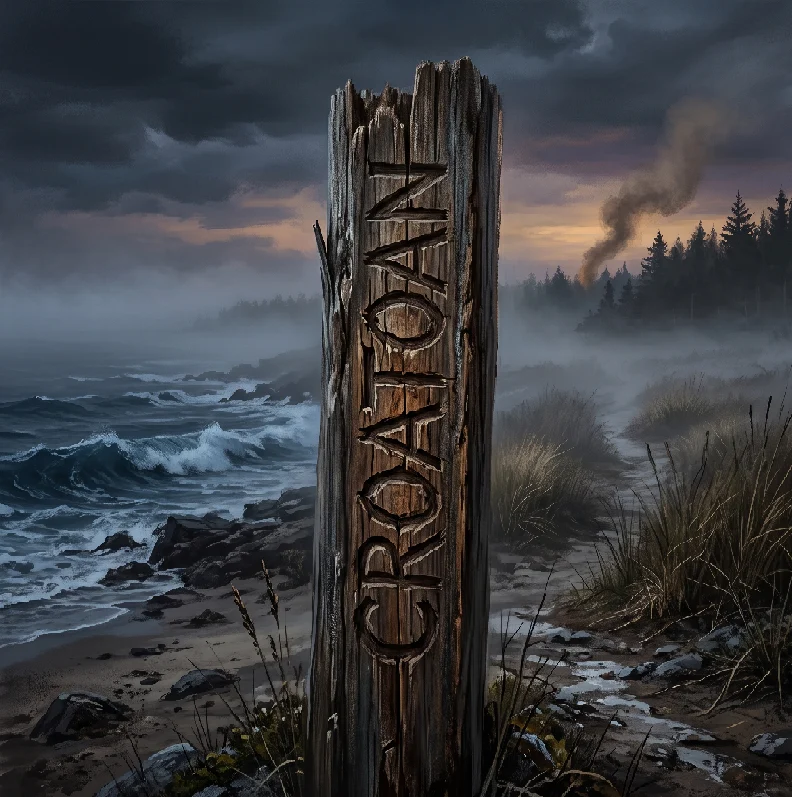
The small settlement had not fallen to a sudden, fiery ambush. The domestic timber cottages were gone, taken down methodically and moved rather than torched in a raid. Standing in their place was a sturdy palisade of heavy pine posts, and on the entrance post, White found the etched letters that launched the Croatoan carving mystery.
The Genesis of the Roanoke Colony in 1587
The expedition of 1587 differed fundamentally from earlier English ventures in North America. Under the financial backing of Sir Walter Raleigh, previous voyages led by Ralph Lane had operated as aggressive military outposts, prioritizing mineral exploration and privateering raids over community building. Those soldiers antagonized regional Algonquian tribes, executing local chiefs and burning fields over minor grievances.
In contrast, the 1587 contingent was designed as an agrarian settlement of families. It comprised eighty-nine men, seventeen women, and eleven children, all bound for the fertile shores of Chesapeake Bay. John White, an accomplished artist and cartographer, served as the civilian governor alongside twelve appointed assistants.
Maritime mismanagement altered their planned course. Simon Fernandes, the Portuguese pilot contracted to navigate the transport fleet, refused to ferry the settlers north to the Chesapeake after a brief resupply stop at Roanoke Island. He insisted that summer was fading and forced the passengers ashore on the sandbanks of the Outer Banks.
The colonists inherited a precarious position. The regional Secotan people harbored bitter memories of Lane’s previous garrison. Stranded in an unfamiliar ecosystem without adequate grain, the newcomers soon recognized their vulnerability. Less than six weeks after the birth of Virginia Dare, the assistants urged White to return to London to secure emergency supplies. He sailed reluctantly, promising to return the following spring.
[The Roanoke Settlement Manifest: 1587]
Total Colonists: 117 individuals
- Adult Men: 89 (weavers, smiths, carpenters, farmers)
- Adult Women: 17 (including Eleanor Dare and Margery Harvie)
- Children: 11 (including two infants born on American soil)
Leadership: John White (Governor) and twelve incorporated assistants
Intended Destination: Chesapeake Bay mouth; actual settlement: Roanoke Island
The Desolate Shore and the Etched Palisades
When White returned in 1590, he carried clear instructions agreed upon before his departure. If the colonists found themselves forced to evacuate under duress, they were to carve their intended destination upon trees or wooden doorframes. Crucially, if they faced physical violence or imminent peril, they agreed to carve a Maltese cross above the text.
Approaching the deserted perimeter, White found the settlement cleared of its personal property. Heavy iron pieces, chests of armor, and lead shot had been buried, though Native inhabitants had dug up several chests, leaving ruined books and rusted tools scattered in the dirt.
At the palisade gateway, White found the letters that established the Croatoan carving mystery:
-
The capital letters CROATOAN were cut deep into the bark of an entrance timber roughly five feet from the ground.
-
On a maritime cedar tree near the sandy beach, the three letters CRO were etched into the sapwood.
-
No Maltese cross was carved above, below, or beside the letters.
-
No human skeletal remains or signs of armed resistance were uncovered in the settlement.
To White, the message seemed plain: the colony had carried out an orderly evacuation fifty miles south to Croatoan Island (modern Hatteras Island). The local Croatan people, governed by Chief Manteo, had maintained steady trade and peace with the English. The lack of a distress symbol suggested an organized migration rather than a massacre, shifting the focus of the Croatoan carving mystery toward cultural assimilation.
The Hurricane That Sealed Their Fate
The chance to confirm their survival evaporated almost immediately. A violent tropical storm swept across the barrier banks the following afternoon, battering White’s flagship, the Hopewell. Anchor cables snapped on the submerged sandbars, and three sailors drowned when their longboat capsized in the breakers.
With fresh water depleted and the crew verging on mutiny, the ship’s captain refused to navigate the shallow, storm-tossed inlets south toward Hatteras. He insisted on sailing to the West Indies for winter refitting, intending to return in the spring.
Circumstances prevented that return. Blown off course and damaged by autumn gales, the fleet limped across the Atlantic to England. Impoverished and politically sidelined, White never raised the funds for another expedition, dying in County Cork, Ireland, without ever learning the fate of his kin.
Logistical Realities: Elizabethan Weapons and Regional Ecology
The material reality of early colonial survival clarifies why the settlers could not hold their ground on Roanoke Island indefinitely. The physical tools available to Elizabethan settlers were poorly suited for long-term defense without external supply lines:
-
Matchlock Muskets: Cumbersome firearms requiring slow-burning cords, useless in damp coastal fogs and heavy rains.
-
Corselets and Morion Helmets: Heavy steel breastplates that restricted movement through maritime swamps and accelerated heat exhaustion during hot summers.
-
Calivers and Pikes: Long, unwieldy ash pikes designed for open European fields, offering little utility in thick maritime underbrush.
-
Ammunition Depletion: Black powder spoiled rapidly in coastal humidity, leaving firearms inoperable within a single season.
[Survival Pressures on Roanoke Island: 1587–1589]
1. Ecological Strain: Severe regional drought confirmed via bald cypress dendrochronology
2. Soil Limitations: Infertile, sandy coastal soils incapable of supporting intensive European agriculture
3. Military Vulnerability: Fragile matchlock firearms and perishable black powder stocks
4. Diplomatic Isolation: Secotan hostility in the north, leaving only the southern Croatan alliance open
Dendrochronological research conducted on regional bald cypress trees reveals that the colonists landed in the middle of the worst drought the region had experienced in eight centuries. Between 1587 and 1589, local crops withered, leaving both Indigenous populations and newcomers short on food. The settlers had no choice but to disband. Their search for food and shelter is central to unraveling the Croatoan carving mystery.
Assimilation with the Croatan: The Primary Hypothesis
The prevailing historical consensus suggests that the colonists survived by integrating into regional Indigenous societies. Rather than vanishing into thin air, the group likely broke into smaller parties to reduce the strain on local food supplies. The main body moved south to Croatoan Island, following the message left on the palisade.
Early colonial records from the seventeenth century support this scenario. When Captain John Smith established the Jamestown settlement in 1607, he heard numerous accounts from Powhatan elders describing European survivors living along the southern rivers:
-
Reports of people building two-story stone houses and wearing tailored garments in the Carolina interior.
-
Accounts of European-style brass tools and iron axes in circulation long before English traders arrived.
-
Persistent traditions among the Lumbee and Hatteras tribes recounting European ancestors who joined their communities.
The survival of the colonists through intermarriage matches patterns found in other early settlements, such as the [Internal Link: Jamestown Starving Time and Algonquian Relations]. When European systems collapsed, cooperation with experienced native populations was the only practical way to avoid starvation.
The Inland Move: Archaeological Clues at Site X
While popular lore focused solely on the beaches of Hatteras Island, historical records show the settlers had considered moving inland from the beginning. Before White left in 1587, the council discussed relocating fifty miles into the mainland interior along the Albemarle Sound.
In 2012, researchers at the British Museum re-examined John White’s hand-drawn map of the Carolina coastline, La Virginea Pars. Using modern multispectral lighting, conservators identified two paper patches covering portions of the map. Beneath one patch, hidden along the mouth of the Chowan and Roanoke rivers, sat a drawn symbol of a four-pointed star fortress.
[Archaeological Assemblage at Site X: Bertie County]
- Surrey-Hampshire Border Ware: Distinctive green-glazed pottery sherds dated to the late 16th century
- Aglet Tips: Elizabethan copper-alloy points used to secure laces on leather doublets
- Lead Seal: English textile trade stamp diagnostic of mid-to-late Elizabethan manufacturing
- Iron Tenterhook: Used by European weavers to dry and stretch wool fabric
The First Colony Foundation launched excavations at the inland location, designated Site X, in Bertie County. Archaeologists uncovered fragments of early English pottery and metal clothing accessories alongside Native artifacts. These findings suggest that a skilled splinter group lived at the interior site for years, broadening the Croatoan carving mystery to include settlements far from the original fort.
Competing Scenarios: The Open-Sea Voyage and Spanish Raids
Alternative theories have also been explored by maritime historians. Some researchers suggest that an impatient faction salvaged timber from damaged supply boats to construct a seaworthy pinnace. Desperate to reach England, they may have sailed directly into the Gulf Stream, only to be overwhelmed by Atlantic gales.
Another possibility involves Spanish military intervention. Philip II’s naval intelligence tracked the English outpost through intercepted letters and interrogated privateers, seeking to remove English settlements from North America. To understand Spain’s counter-reconnaissance efforts along the Atlantic coast, see our detailed breakdown of [Internal Link: Anglo-Spanish Maritime Warfare in the New World].
Spanish archives in Seville record that a caravel was dispatched from St. Augustine in 1588 to locate and destroy the settlement. The Spanish ship found the shallow Outer Banks inlets impossible to cross and returned south without landing. While the Spanish did not wipe out the settlement, their ongoing naval patrols prevented English rescue ships from relieving the colonists.
Technical Specifications: The Material Culture of the Outer Banks
The physical evidence left by sixteenth-century settlements is small, but modern digs continue to turn up diagnostic artifacts. Fieldwork conducted by the Croatan Archaeological Project on Hatteras Island has produced materials that point toward European presence:
-
Border Ware Ceramics: Glazed cooking pots fired in Surrey and Hampshire kilns, common across southern England between 1560 and 1600.
-
Gunflints and Musket Balls: Cast lead shot showing diagnostic scissor-sprues and early European iron gun springs.
-
Brass Nuremberg Jettons: Cast casting counters used by merchants to calculate accounts, commonly carried by Elizabethan colonial accountants.
-
English Tobacco Pipes: Hand-rolled clay pipes featuring distinctive small, bulbous bowls that preceded the wide-flaring styles of the seventeenth century.
These artifacts confirm that Elizabethan goods reached Native settlements on Hatteras Island during the late sixteenth century. Whether obtained through direct intermarriage, salvage, or regional trade, they show that the word carved on the palisade pointed straight to the communities where the settlers left their mark.
The Legacy of the Lost Colony
Four centuries later, the fate of the Roanoke settlers continues to capture the popular imagination. The sudden silence that greeted John White helped shape early American folklore, inspiring myths of mystical vanishings and ghost fleets along the Carolina coast.
Examined through archaeology, the event looks less like a supernatural vanishing and more like a human story of adaptation. The settlers were not lost in a wilderness; they joined established cultures that had thrived along the Atlantic coast for generations. The Croatoan carving mystery was an emergency notice left for a relief fleet that never made it back in time.
The carved letters weathered away, but the physical remnants left in the Carolina soil tell a lasting story. They show an ambitious English expedition that, cut off from home by transatlantic warfare, made common cause with their neighbors to survive on the Atlantic coast.
Frequently Asked Questions
What was the meaning behind the Croatoan carving mystery?
The word CROATOAN carved on the palisade post was a pre-arranged message left by the Roanoke colonists to show they had relocated to Croatoan Island (modern Hatteras Island). Governor John White instructed them to carve their destination if they moved, and the absence of a Maltese cross signaled that the evacuation was organized rather than a response to an attack.
Why did it take John White three years to return to Roanoke Island?
White returned to England in late 1587 to secure food and supplies for the colony, but his return was blocked by the outbreak of war with Spain. Queen Elizabeth I requisitioned all ocean-going vessels to face the Spanish Armada in 1588, leaving White stranded in England until privateering ships agreed to carry him back in 1590.
What is the most likely fate of the Roanoke colonists?
Most historians and archaeologists conclude that the starving colonists integrated into regional Indigenous communities. Confronted by severe drought and failing supply lines, the settlers likely dispersed into smaller groups, with one contingent joining the friendly Croatan people on Hatteras Island and another moving inland to live along Albemarle Sound.